On a recent introductory week in Georgia, we started with a few days in the capital Tbilisi, after which the mountains were calling. However, never did we imagine that the road trip to Kazbegi in the north of Georgia would be so memorable. It’s a challenging drive around hairpin bends, taking you over the Jvari Pass, with incredible views of snow-capped mountains, waterfalls running down to the road, watchtowers, monasteries and sculptures, which means the Georgian Military Highway is a drive you will never forget.
“I have survived the Georgian Military Highway.
It isn't a highway, but poetry.”
Anton Chekov (1888)
⚡ Overview
The Georgian Military Highway is one of the most spectacular drives in the Caucasus, winding through dramatic mountain landscapes, ancient monasteries, and impressive high passes between Tbilisi and the Russian border. Highlights include the stunning Gergeti Trinity Church with its backdrop of Mount Kazbek, the epic Jvari Pass at over 2,300m, and the charming mountain town of Kazbegi for hiking and glacier views.
Intrigued? Read on to find out why….
Table of Contents
What is the Georgian Military Highway (GMH)?
The Georgian Military Highway is an ancient trade and transit route through the Caucasus mountains, connecting Tbilisi in Georgia with Vladikavkaz in Russia. People have travelled this corridor since well before the first century BC, for one simple reason. It was one of the only realistic ways through the wall of mountains that separate Europe and Asia. Merchants and whole migrating populations moved goods, ideas and culture along it, and writers as far back as Strabo and Pliny the Elder noted its importance on the wider networks linking the Black Sea and the Caspian.
It has carried far more than traders, though. Roman, Persian, Byzantine, Mongol and Ottoman armies all passed this way, each understanding that whoever held the route held real influence over the region. The name we use today came later – In the late 18th and 19th centuries the Russian Empire rebuilt the rough mountain trail into a proper military road, designed to move troops, secure borders and extend control during conflicts such as the Caucasian War. That effort turned an old path into something far more dependable, and in doing so it opened the route up to trade and travel rather than just soldiers.
What survives now is one of the most dramatic drives in this part of the world. The road runs for roughly 212 kilometres, or 132 miles, between Tbilisi and Vladikavkaz, climbing through gorges and over high passes, pairing a deep sense of history with scenery that is hard to forget. If you love a road trip that actually means something, this is one for the list.
Where is the Georgian Military Highway?
The Georgian Military Highway, or Highway E117, is a 200 km (124 mile) long road connecting Georgia with Russia.
The Highway officially starts near the village of Natakhtari, Georgia, about 27 kms north of Tbilisi, and ends in Vladikavkaz, Russia, to the north.
The Georgian Military Highway passes through the high mountains of Mtskheta-Mtianeti, which form the spine of the Greater Caucasus in eastern Georgia. It is this geographical position, which makes the Highway so tricky to navigate, both in terms of making and maintaining the road, and travelling along it.
Kazbegi (Stepantsminda) is the closest town to the Russian border on the Georgian Military Highway. Kazbegi sits about 10km south of the Kazbegi-Verkhniy Lars border crossing, the only road border crossing between Georgia and Russia formally operating.
Kazbegi therefore makes the ideal destination for an overnight stop when you drive from Tbilisi, partly due to its location, but also because of its magical setting surrounded by snow-capped mountains.
Zhinvali Reservoir Viewpoint
History of the Georgian Military Highway
Originally the Georgian Military Highway was a simple horse track, and the only way to pass through the large and challenging Greater Caucasus mountain range between Georgia and Russia.
💡
Tip: Look out for watchtowers
As you travel along the Highway you will see numerous stone watch towers in prominent positions on the hills, once used as relay signal stations in case of invasion and danger.
The Georgian Military Highway was converted into a carriage road by 800 Russian soldiers in 1783, which is an impressive achievement given the mountainous terrain and altitude.
Although the route lost some of its significance following the opening of a railway line along the Caspian Coast in 1883, it remains an important trade route between the two countries. More broadly, the Highway is a key transit artery between Central Asia and Europe. Lorries coming from Russia bring wheat, food and building materials; Lorries from Georgia take wine, fresh produce from Armenia and industrial goods from Turkey.
Road carved into the hillside
To improve this trade route, iron bridges have been added and the road is constantly being maintained due to the impact of heavy traffic and harsh winter weather conditions such as snow and ice.
Today, a 9 km tunnel is under construction through the mountains which will negate the need to use the Jvari Pass over the mountains. This will take lorries off the small mountain pass roads, making the journey much safer for other drivers, and in turn, quicker for the lorries. It will also allow the road to remain open year-round.
You may see hundreds of lorries and trucks parked in lines along the side of the Great Military Highway. This is a strategy to manage the amount of heavy traffic on the roads – if all the lorries were mobile at the same time, they would impede the movement of cars (tourists and locals), so the lorries are managed by patrol police who stagger their progress along the Highway. This also prevents Customs from being overwhelmed with lorries at the Border.
What are the road conditions like on the route?
The Georgian Military Highway is a single lane each way and so, can be slow going at times; take this as an opportunity to soak in the incredible scenery. Leave your ‘Speedy Gonzales’ head at home for this trip!
Driving the Jvari Pass
Different phases of the drive
In our opinion the Georgian Military Highway has four ‘unofficial’ phases:
The south section of the Highway is very straight and lined with locals selling honey or bottles of home distilled Chacha which is probably quite lethal!
The Highway follows the Argavi River on the south side of the mountains, gently curving through the valley before moving up into the hills. Look out for waterfalls appearing through the tree covered hillsides and even trickling down to the roadside in some places.
The next section of the Highway is a thrilling drive as you negotiate a series of steep hairpin bends and climb over the Jvari Pass (2,395 meters). Our little Hyundai needed to cool down when we got to the top! The views are quite incredible, as you get closer to the snow-covered peaks.
Once over the mountain pass and back in the valley, the road then follows the Terek River towards the Russian border.
For confident drivers only
You do need to be a very confident, and preferably experienced, driver to tackle the Georgian Military Highway because there is a lot to deal with on the road, such as:
The condition of the road is very poor in places, with large potholes and uneven surfaces which could easily ruin your tyres. At times, it felt like driving in a ‘Space Invaders’ arcade game, dodging the large potholes, whilst avoiding on-coming traffic also weaving around the potholes.
As mentioned above, the Highway is single lane traffic each way, and in some places, there is not enough space for two lorries to pass. The lorry drivers know how to make it work, so you just have to be patient whilst they sort themselves out.
Where there are lorries parked up by the side of the road waiting for permission to proceed to the border, they take up half a lane of the road, which can make passing the parked lorries a tight squeeze if there is traffic coming the other way – breathe in!
The ‘Georgian style’ of fast driving and overtaking can take some getting used to. In summary, cars will pull out to overtake you, regardless of whether there is a blind bend ahead, or small gaps before on-coming cars. That said, Georgian drivers are good at letting cars pull back in when needed (which British drivers might be reluctant to do given our commitment to queuing and being orderly!).
As well as avoiding lorries and cars, there are many places on the Georgian Military Highway where cows suddenly appear on the road. I lost count of how many times we had to slow down to wait for cows to move along.
Cows in the road
This all makes for a very exciting drive through stunning landscapes, with roads that curve around mountains, cross bridges, pass through tunnels, and run alongside avalanche galleries.
💡
Tip: Rental cars
A cautionary note to make sure your rental car will be able to cope with hills! 4x4 recommended.
Impact of the weather
On our way to Kazbegi we enjoyed glorious sunshine and incredible views of the mountains, however on the day we travelled back to Tbilisi, the weather arrived. It rained heavily in the morning, before clearing up but leaving a mist swirling around the mountains, and the road – visibility was reduced, and water was pouring down the mountains, which made for a very different driving experience.
There are snow tunnels and avalanche galleries to help protect the road from wintery conditions, and to allow the trucks to move across the Jvari Pass during inclement weather. However, even with these structures in place to help, the road can close between November and May due to poor weather.
Water streaming over the Avalanche reinforcements
How long to drive the Georgian Military Highway?
From Tbilisi to Kazbegi, the journey can take between 3-4 hours depending on traffic (and cows) on the road. In addition, allow time for refreshments and sightseeing stops.
Whilst it is possible to do the trip there and back in a day, it is a hard drive requiring lots of concentration so it can be tiring. If you have the time, aim to stay in the mountains for one or two nights before tackling the road back south again. The mountains are so pretty that you won’t be in a hurry to leave anyway.
Alternatively, take a tour and let someone else do the driving (see below).
If you are driving, the best advice is to take your time on the Georgian Military Highway and make stops to break up the journey- be kind to the driver!
Where to stop on the Georgian Military Highway
💡
Tip: Driving stops
The Georgians drive on the right-hand side of the road, so on the way north, chose to stop at places on the right-hand side, whereby it is less hazardous to turn off the road. Then, stop at different places on the journey south.
There are some great places to stop on this special route. Potential stops might be:
Chronicles of Georgia
Whilst technically not located on the Georgian Military Highway as it sits 25 km south of Natakhtari (30 minutes north of the centre of Tbilisi), the Chronicles of Georgia should not be missed if you haven’t visited it previously.
The Chronicles of Georgia is an impressive hilltop monument which you can see for miles around. It was designed by Russian-Georgian artist, Zurab Tsereteli. Construction started in 1985 and technically has never finished.
The monument features 16 pillars up to 35 meters tall; it is difficult to photograph in one frame because it is so large, but you can have fun trying.
The Chronicles depicts scenes from the bible which are important to the Georgian Orthodox Church, as well as Georgian historical figures, including its monarchs. After years of struggle with its neighbour Russia, the monument aims to promote Georgian stories and values. It is free to visit and open 7 days a week.
To the side of the Chronicles is a sculpture version of St Nimo’s cross (see Jvari Monastery below).
Behind the Chronicles of Georgia, there is an old church with impressive carved wooden doors, and a viewpoint over blocks of Soviet Era flats to one side and the turquoise Tbilisi Sea to the other side. Compare and contrast!
300 Aragveli Monument
25 km north on GMH
As you drive north, you will see a striking monument ahead of you – a tall concrete structure with carved stone figures around the middle of the statue, topped with iron spears. The monument, 300 Aragveli, commemorates a group of 300 brave highlanders from the Aragvi Valley who lost their lives defending Tbilisi from invading Persian forces at the Battle of Krtsanisi (1795).
The Soviet style monument built in 1959 and designed by architect A. Bakradze, is located on the right-hand side, with an area you can pull into just before it; good for a quick photo stop and to stretch your legs.
300 Aragveli Monument
Zhinvali Reservoir Viewpoint
27 km north on GMH
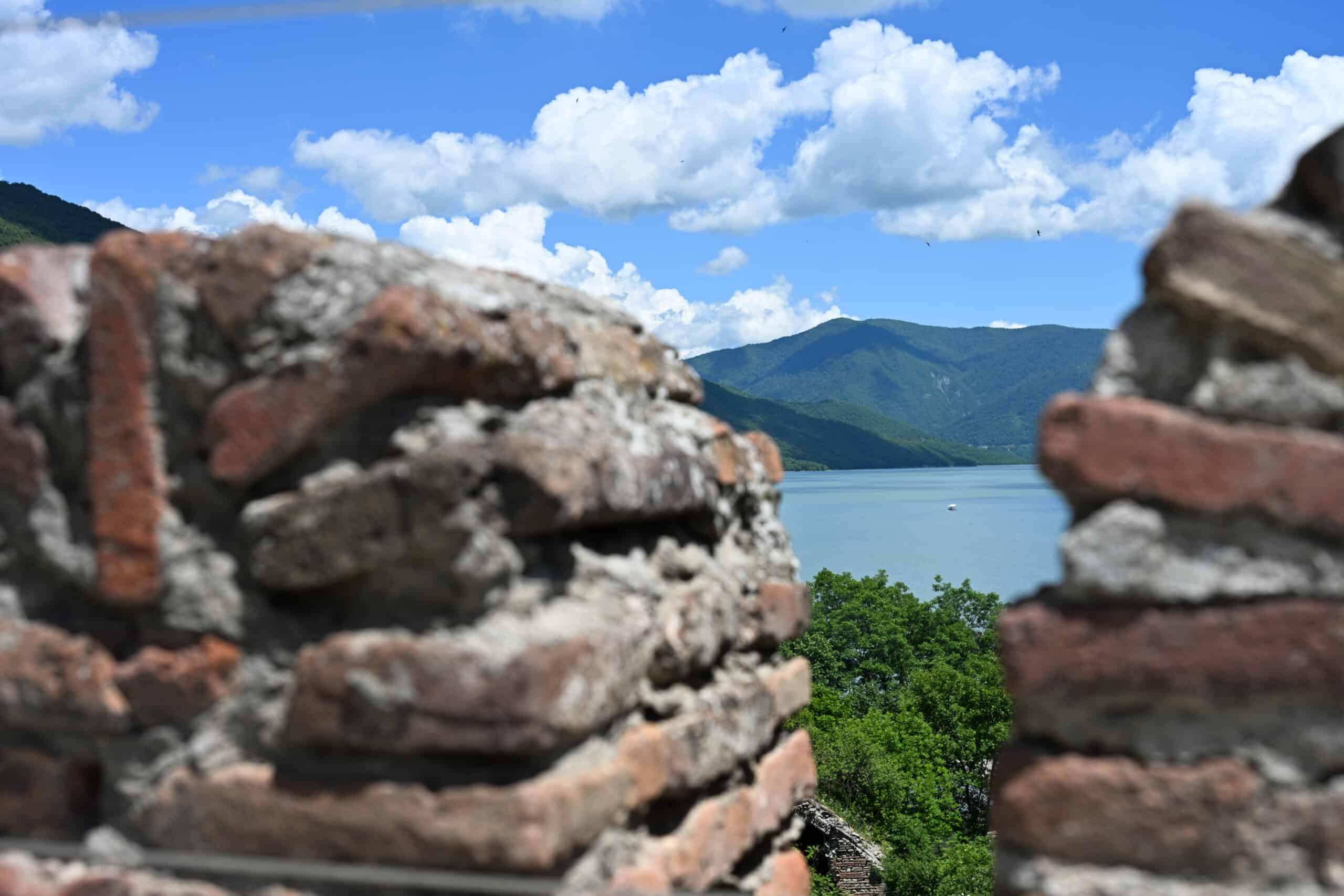
As you continue driving north, around 70km from Tbilisi, the road brings you to the Zhinvali Reservoir on your right. This hydroelectric dam was built in 1986 to provide water for Tbilisi and help with flood defences.
Zhinvali Reservoir
The edge of the reservoir is lined with stall holders and scenic viewpoints looking over the turquoise blue man-made lake. Most of the scenic pullover points offer some combination of hearts, swings, and/or decorated arches for photo opportunities. If you want to purchase a cheap souvenir, or even an eye-catching white sheepskin hat, then this is the place to do so. You can also get coffee and snacks if you need them.
Sheepskin hat anyone?
Ananuri Fortress Complex
35 km north on GMT
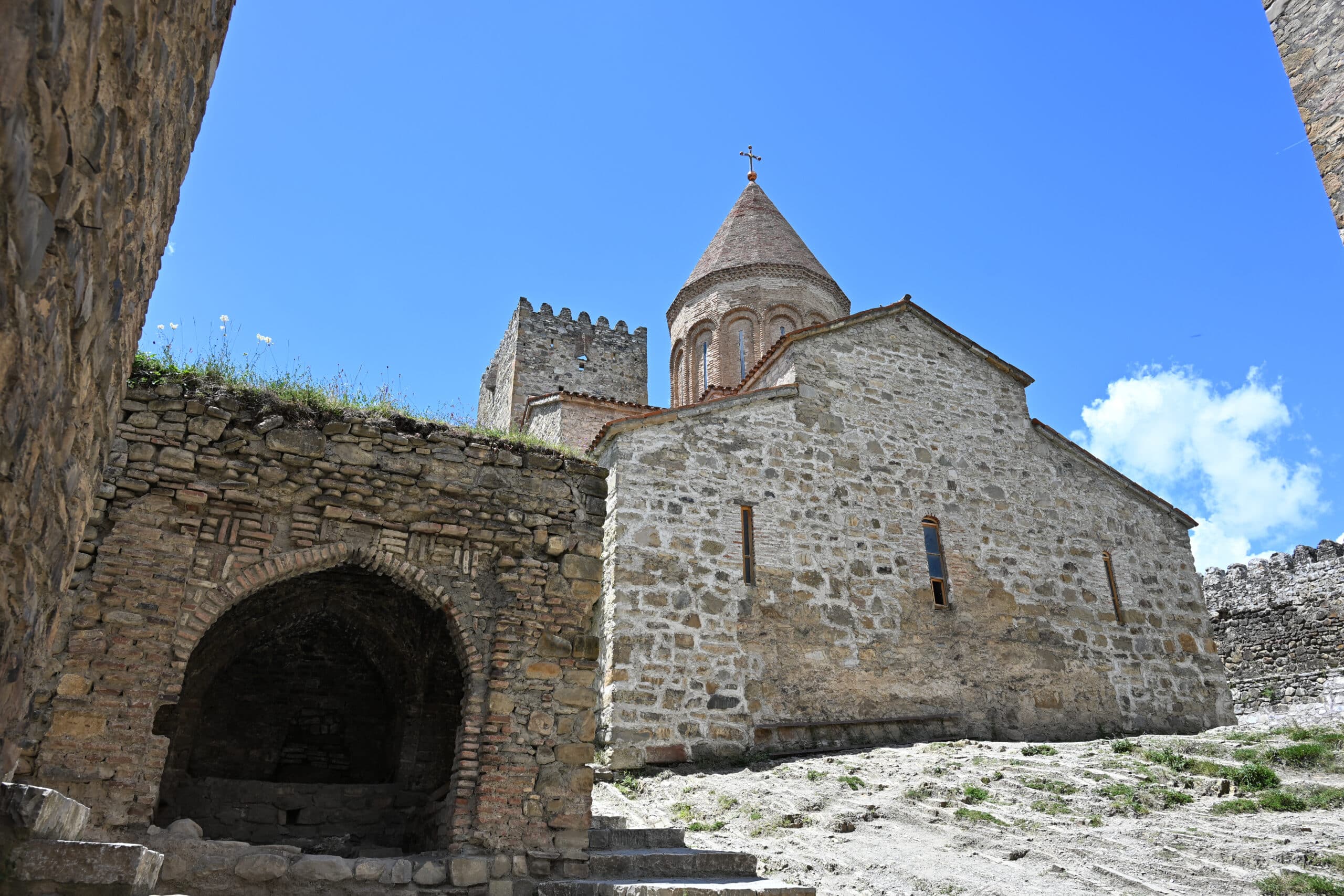
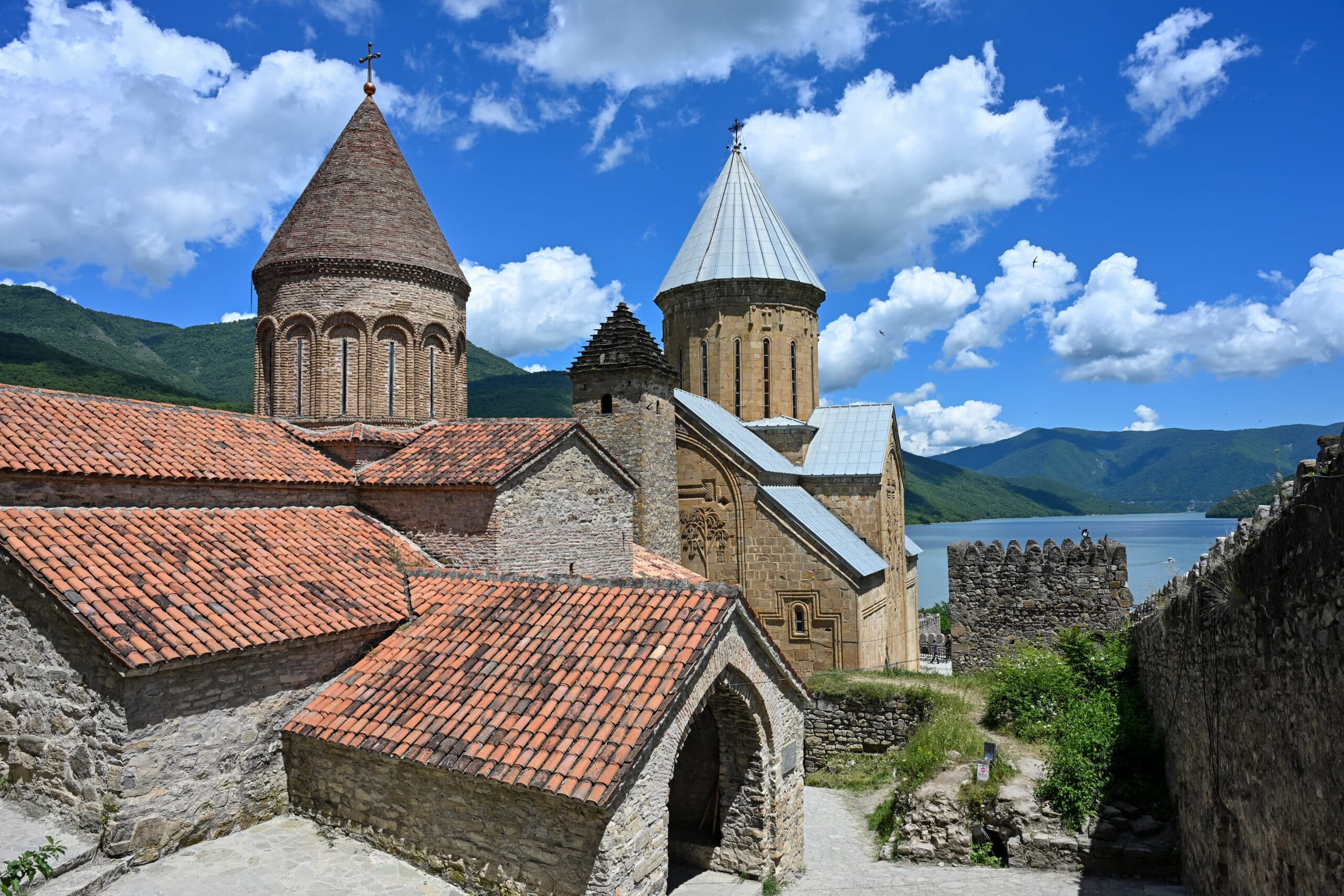
The late Medieval Ananuri Fortress is a stunner, sitting on rocks overlooking the Zhinvali Reservoir. The Fort belonged to the rulers of Aragvi in the 13th – 18th centuries to help protect the region from attack and defend the road through the South and North Caucasus.
There is a large car park in front of the Fortress (5 GEL or Georgian Lari, paid on exit). Once you have parked your car, walk back over the road bridge to take a good photo of the Ananuri Fortress and water from the side.
Ananuri Fortress - view from the bridge
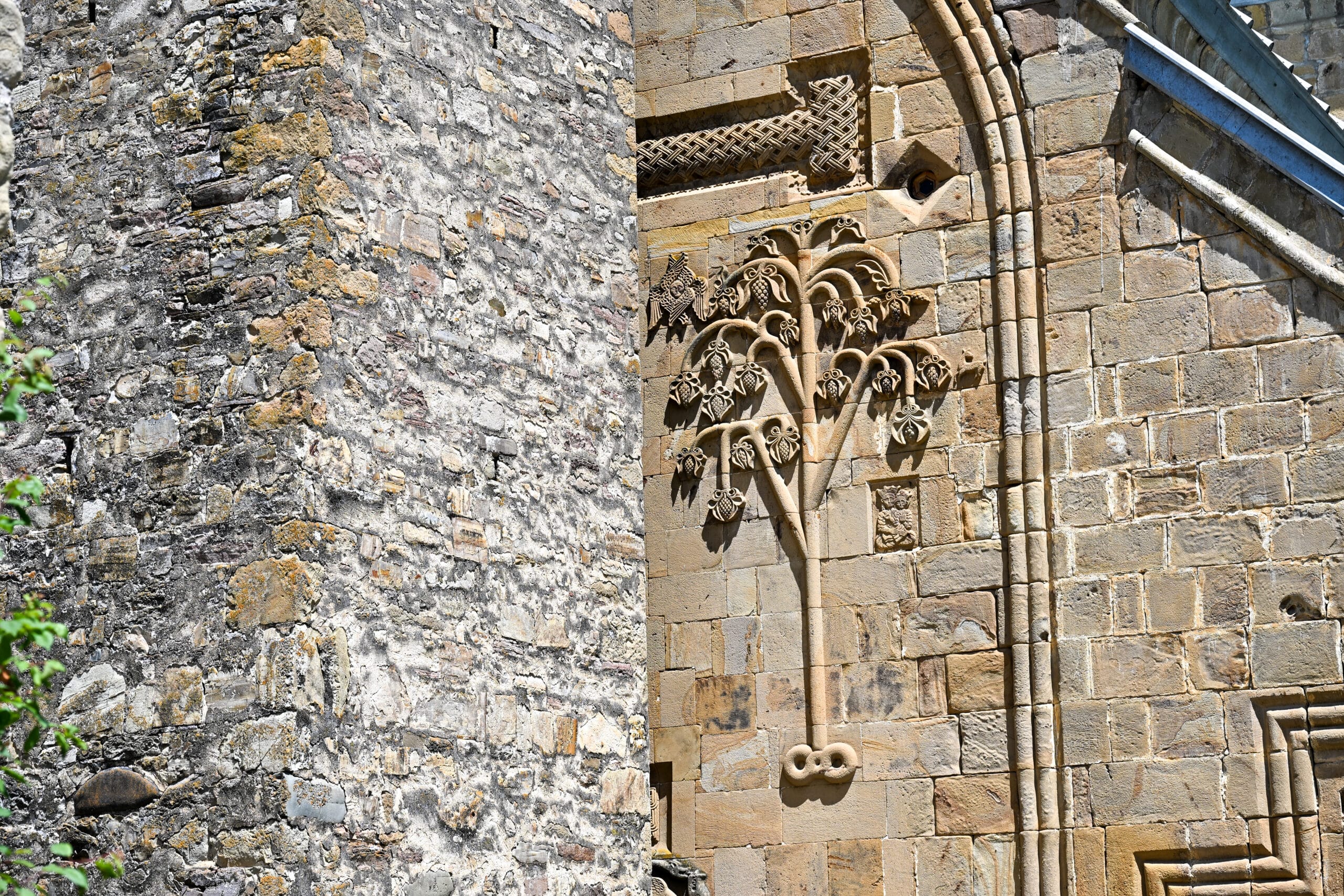
The Fortress Complex comprises 3 separate church buildings and bell tower, largely within a crenellated fortress wall.
Church of the Virgin (1689) is the largest church on site, with lovely frescoes, some of which were destroyed in a fire. The other two churches are the: Church of the Deity (16 or 17th century) and the smaller Church Mkurnali.
There is a sign outside the Fortress reminding visitors of the correct attire to enter the churches – as a rule of thumb, women should cover their heads and legs, although scarves and skirt wraps were available to borrow if needed.
Church dress code
A set of short steps leads to the bell tower along the fortress wall. Whilst they don’t look particularly hazardous, they are steep, narrow and without any barrier to the right-hand side – one wobble, and you might fall off. However, if you fancy the challenge then you will get the best view of the fortress and reservoir from the steps.
You only pay for the car parking and not for entry to the fortress itself. This was a common theme on our trip to Georgia and made us wonder how they afford to upkeep these important sites.
💡
Tip: Cafe stops
Below the fortress, at water level, there looked to be a couple of cafes and boats to hire which looked good fun. We didn’t venture down, but I would imagine the views of the fortress from the boats would be impressive if you had time.
Pasanauri
58km north along the GMH
Pasanauri is a small town on the Georgian Military Highway, and the only town between Mtshketa and Kazbegi. If you want to stop for food and drinks on your way north, there are some good options by the side of the road as you exit the north end of town.
River rafting
This area is also good for river rafting if you have time and want a thrill on the water. There are several tour companies offering trips, or you could book a rafting tour from Tbilisi such as this one:
After Pasanauri, the road starts to head up into the mountains, and the drive becomes more challenging. We decided to power through and save the rest of the stops for our return journey, although of course you can stop whenever you feel that you need or want to take a break.
Russian-Georgia Friendship Monument
94 km north on the GMH
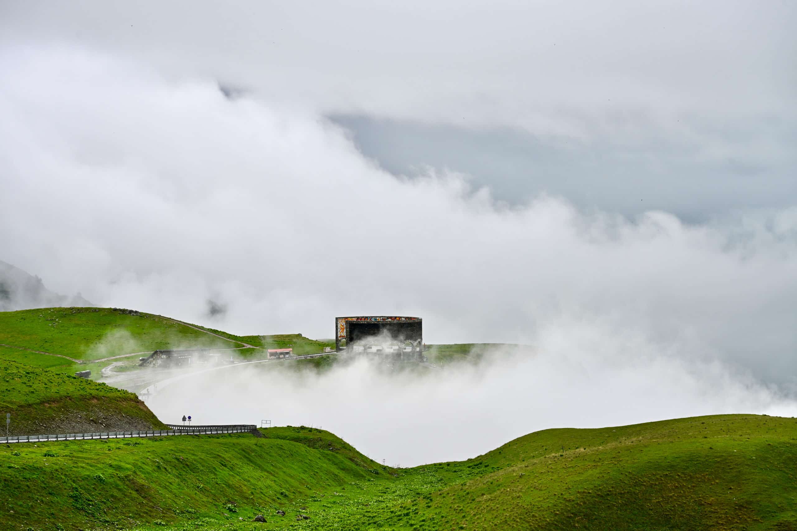
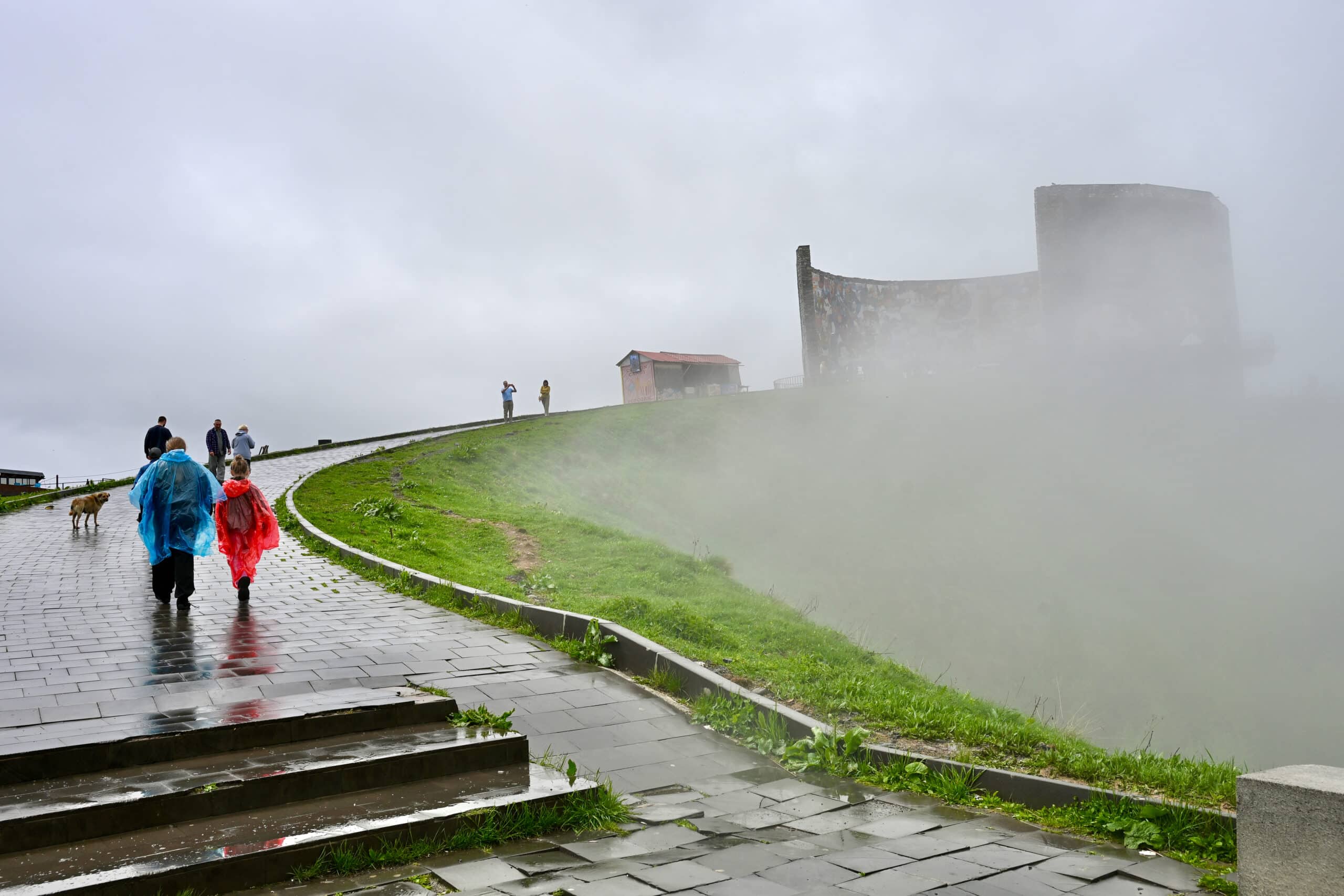
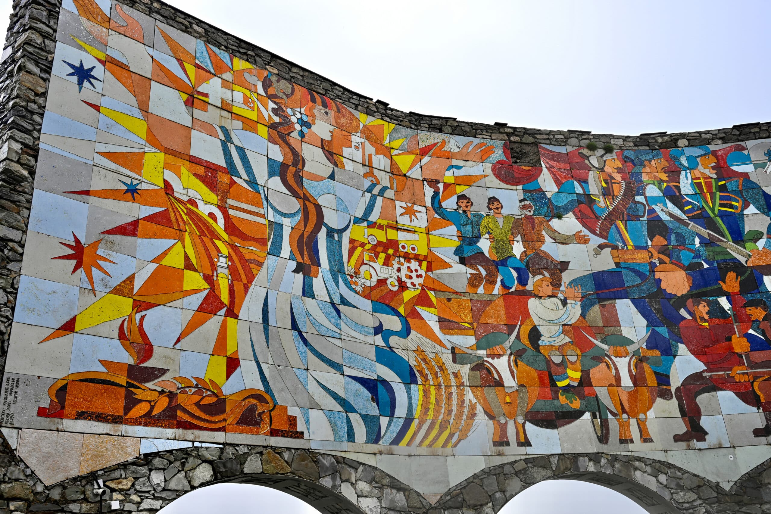
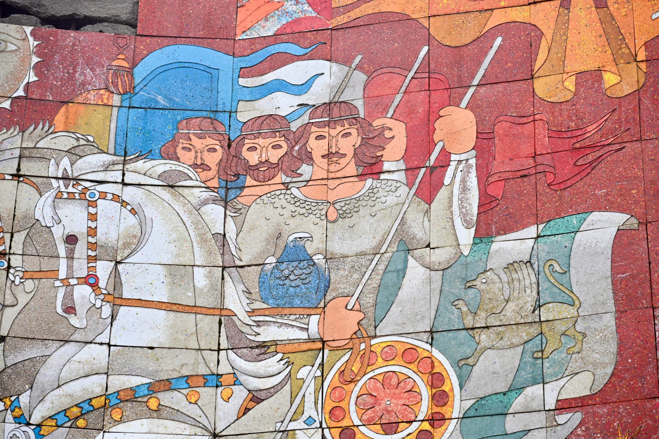
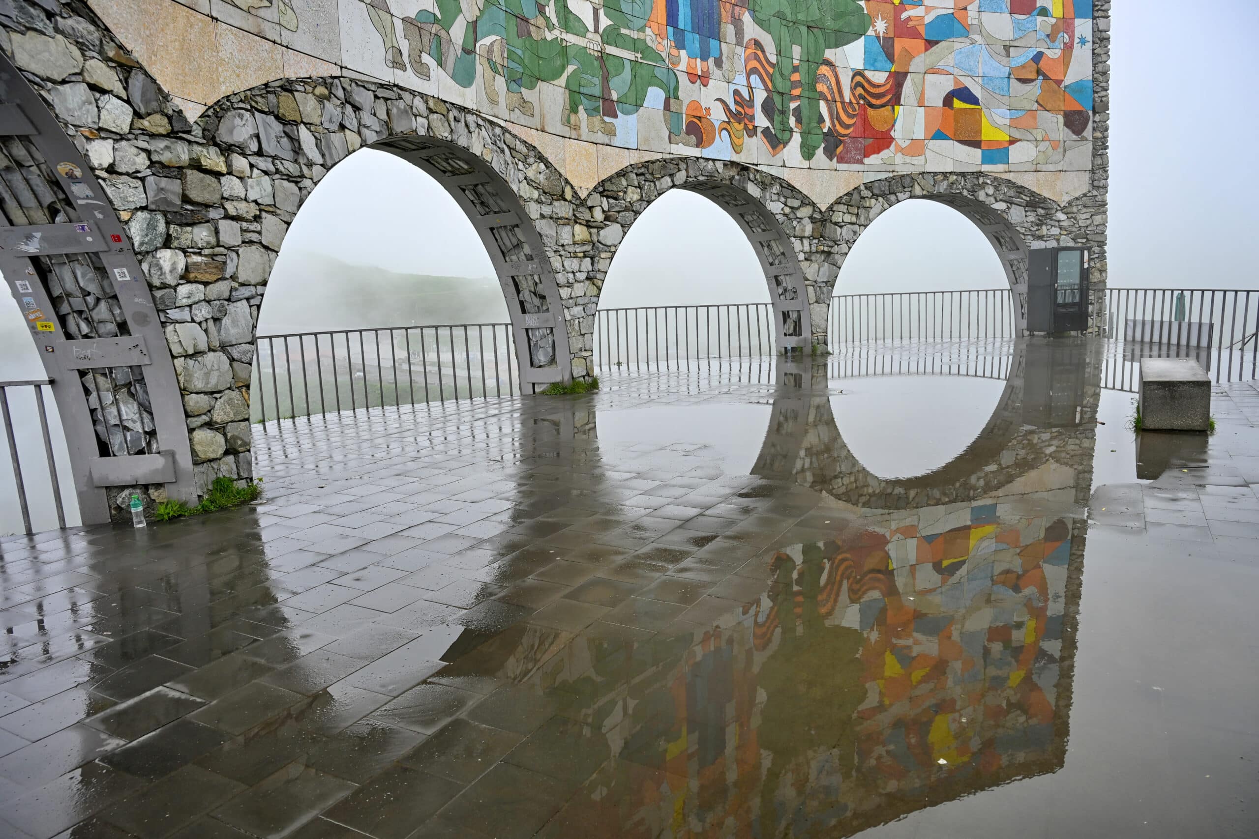
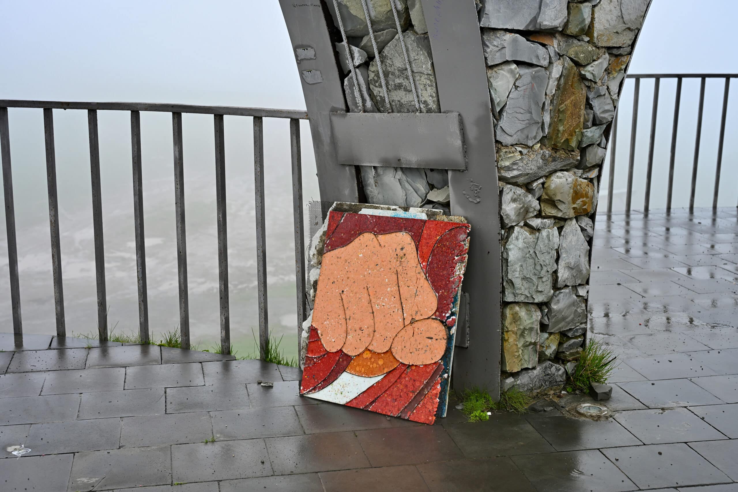
As you ascend the mountain pass and turn one of the corners, a large circular concrete structure presents itself on the left-hand side. This is the 70-meter-wide Russia-Georgia Friendship Monument, built in 1983 to commemorate 200 years of Russian and Georgian ‘friendship’ and the Treaty of Gurgievsic.
The monument is curved so that you walk into the middle of it and admire the colourful murals on the inside of the curve. The murals depict scenes highlighting significant events and figures from Georgian and Russian history, including: Georgian soldiers with brown eyes on horseback and Russian soldiers with blue eyes on horseback, the Kremlin, Russian astronauts, and the Georgians as agricultural figures.
Make your own mind up about whether this is truly a mural of ‘friendship’ or whether it has an element of propaganda about it. Some Georgians refer to the monument as ‘Panorama Gudauri’ instead.
Russian-Georgian Friendship Monument in the mist
We visited the Monument on our way back to Tbilisi and it looked impressive standing in its prominent position on the mountainside as we descended the mountain. However, as it was a rainy day, the Monument was shrouded in mist, looking very atmospheric. On the flip side, this did mean that we couldn’t see anything from the various photo spots and viewpoints around it – just cloud!
Gudauri Viewpoint
95 km north on the GMH
The road then ascends to the winter sports town of Gudauri, the highest settlement on the Georgian Military Highway at 2,000 meters. Whilst there is not much of interest in Gudauri out of ski season, you can stop at the Gudauri Viewpoint for fabulous views of the Higher Caucasus mountains.
Seasonally, a cable car is open between Kobi in the valley and Gudauri, which is said to have wonderful views and is the longest cable car in Georgia. This was not open when we visited in June.
The sculptures of Sno Village
121 km north on the GMH
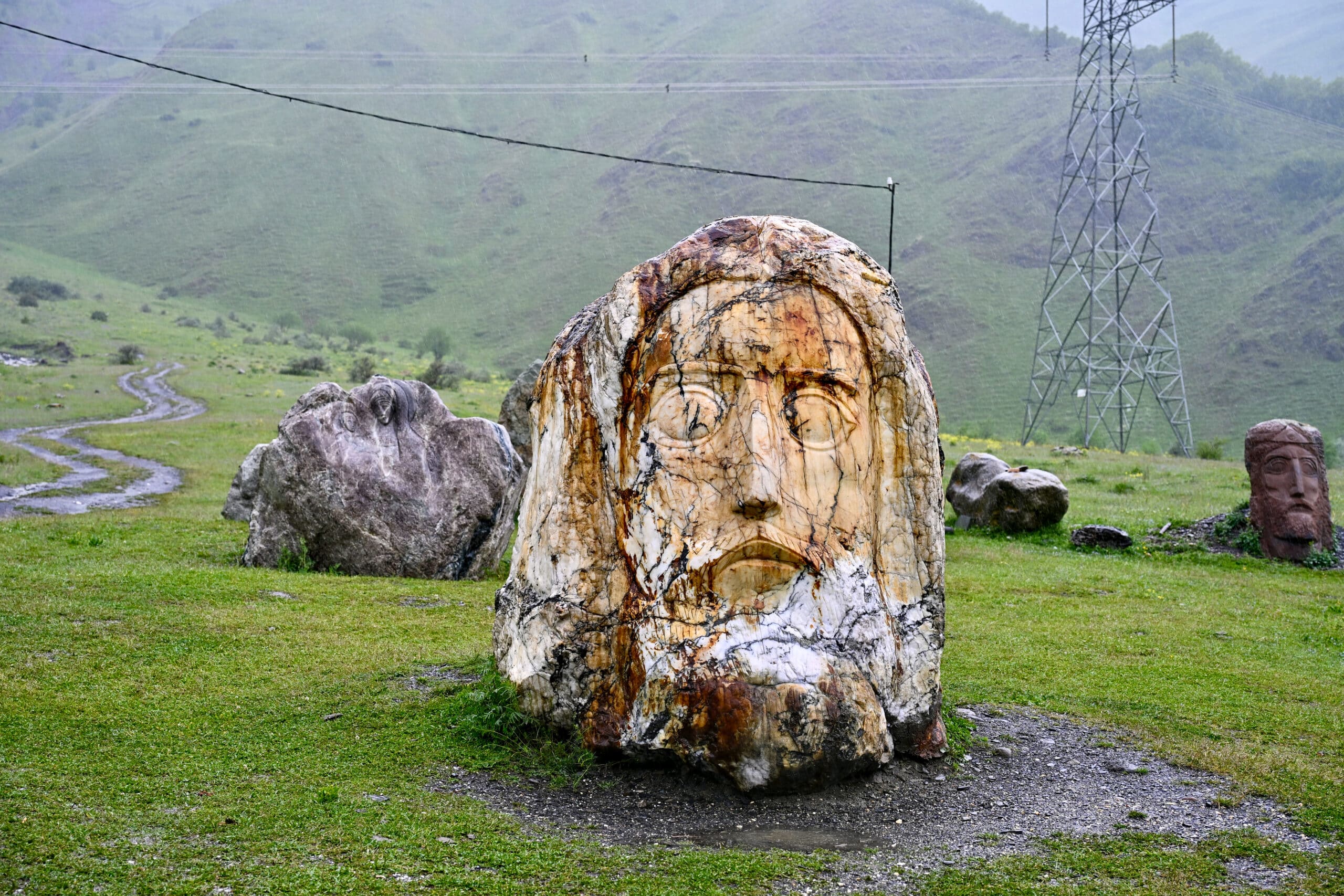
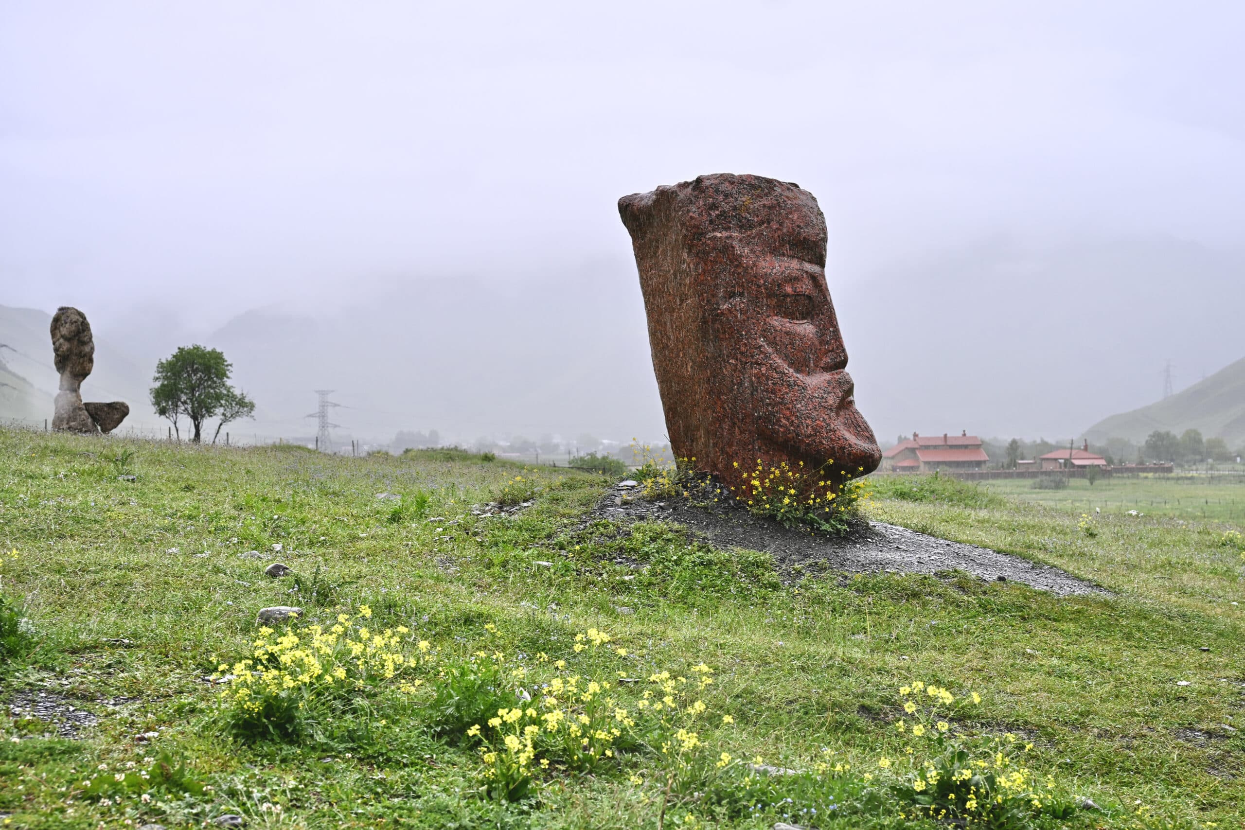
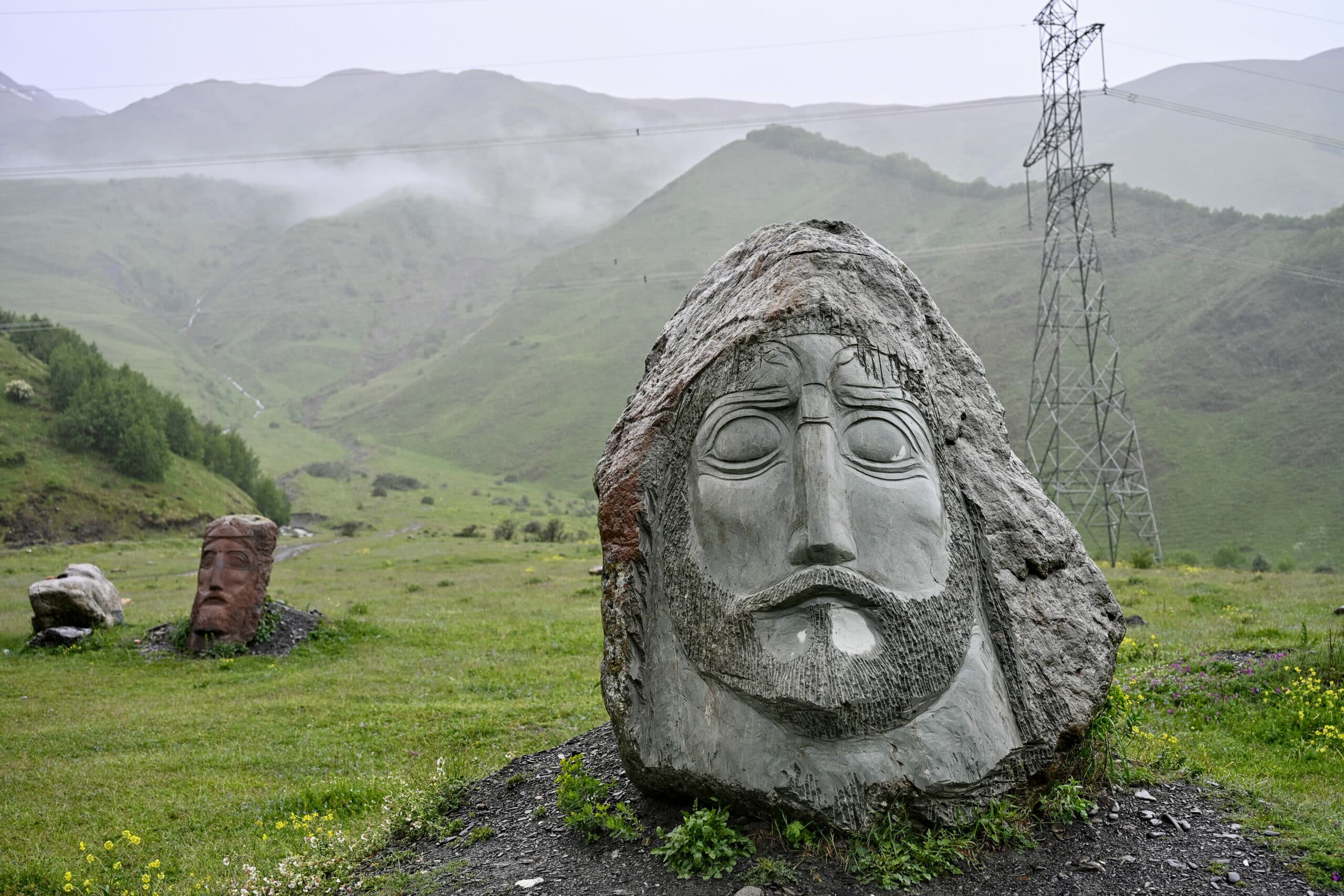
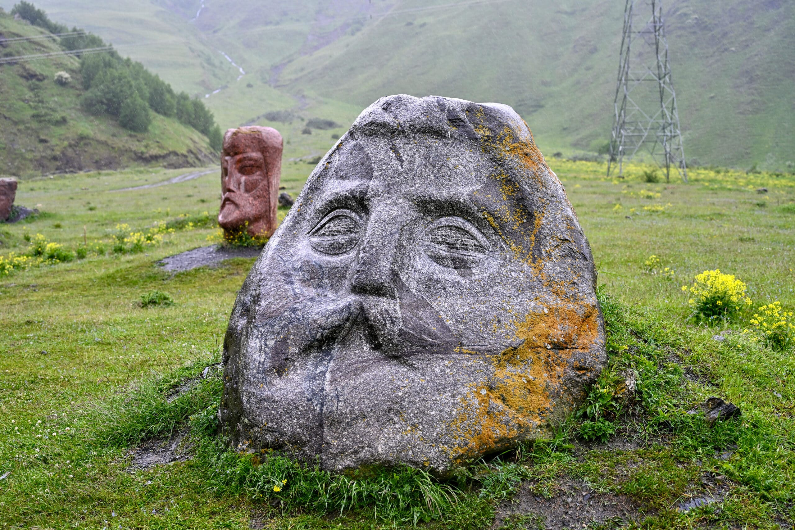
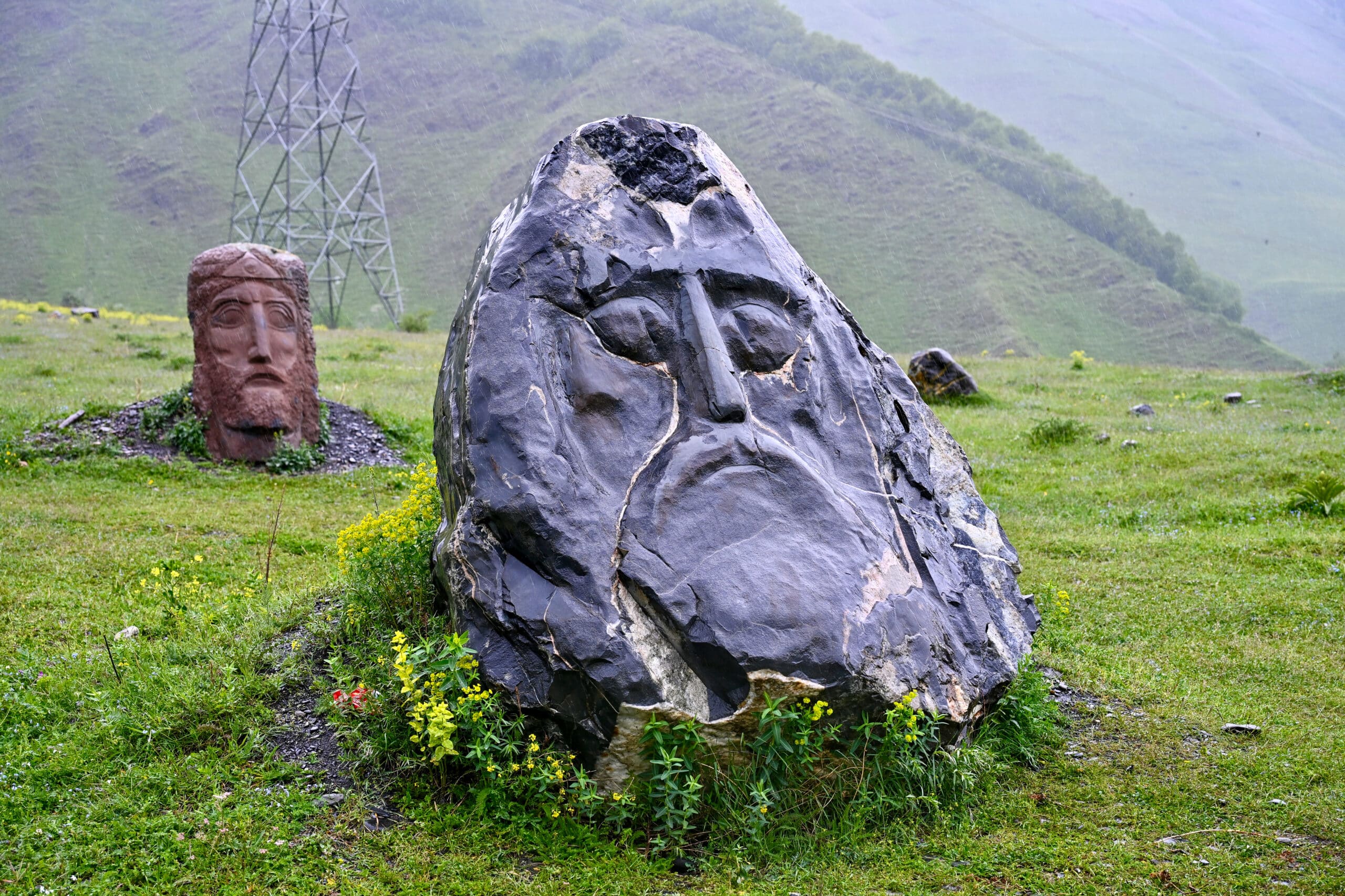
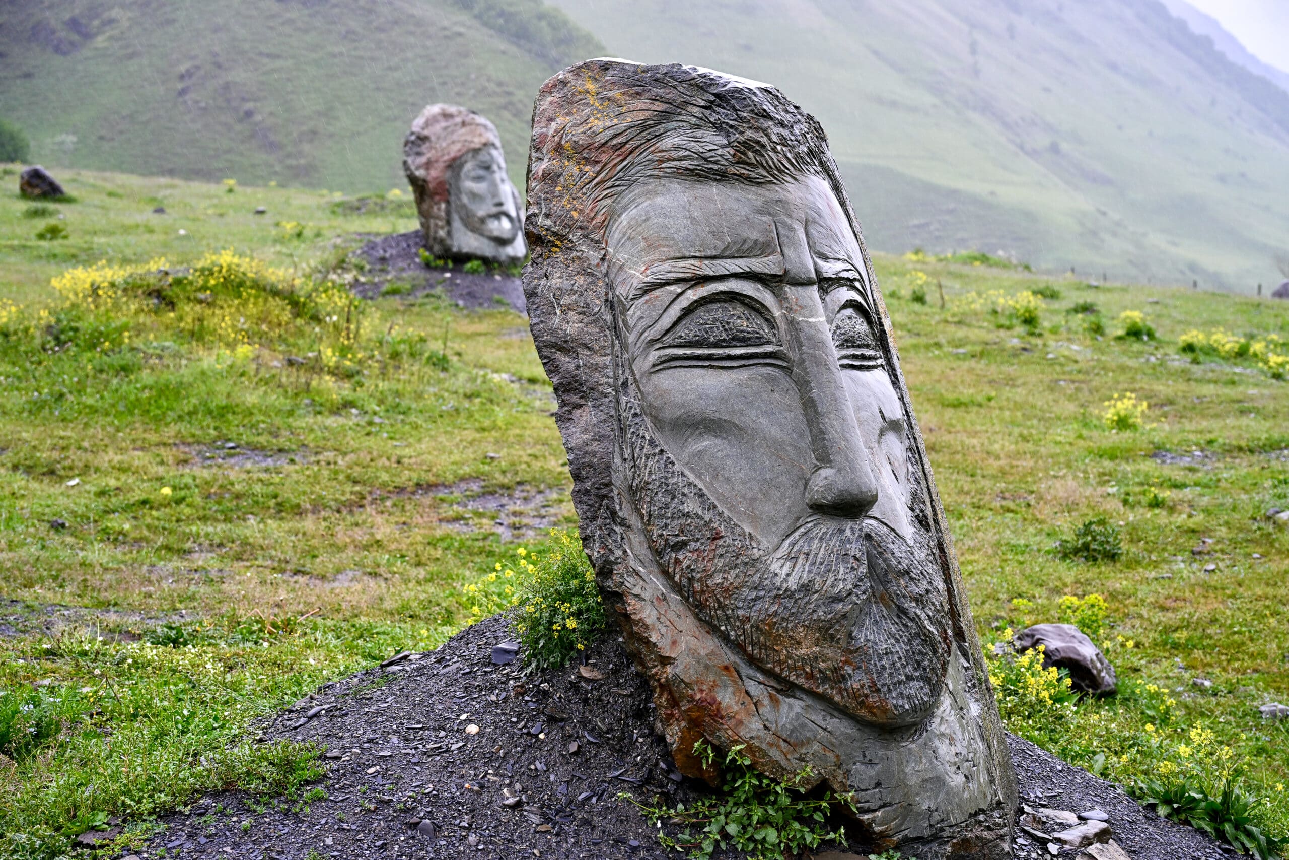
Just before you enter the town of Kazbegi, you can take a small detour off the Highway, to the tiny village of Sno. Just before you reach the village, you’ll discover a group of carved stone heads clustered in a field full of meadow flowers, with the mountains behind it.
These sculptures were carved by local artist, Merab Piranishvili, and each represents a famous Georgian writer, poet or leader. I liked the fact that the sculptures were made from different coloured stone, in all shapes and sizes – like the people he was trying to represent, everyone is different!
Stay overnight in Kazbegi (Stepantsminda) at the impressive Rooms Hotel Kazbegiand enjoy marvellous views of Mount Kazbek, the third highest peak in Georgia at 5,054 meters, with the much-coveted Gergeti Trinity Church on its slopes. Then, if you have the time, you could drive a bit more of the Georgian Military Highway the following day towards the Russian border and Dariali Monastery.
Signpost in Kazbegi
Return Journey - Jvari Monastery, Mtshketa
Again, not technically on the Highway, but the Jvari Monastery makes a good stopping point if you are returning to Tbilisi or travelling onwards to other places such as the Khaketi Wine Region as we were.
Logistically, the Monastery is a good place to stop as it stands on the hills overlooking Mtshketa, the ancient capital of Georgia. As its on the opposite side of the river, you can access it easily from the main roads, without needing to negotiate driving in Mtshketa.
However, the Jvari Monastery is more than just a convenient pitstop, it is also part of a UNESCO World Heritage Site comprised of 3 Mtskheta buildings; the other two being Svetitskhoveli Cathedral and the Samtavro Monastery, both in the town of Mtskheta itself.
To many Georgians, the Jvari Monastery is one of the holiest religious sites, relating to St Nino and the conversion of Georgia to Christianity in the 4th century.
Who was St Nino?
Nino was the daughter of a Roman general who grew up in Jerusalem. Legend has it that she experienced a visitation from the Virgin when she was only 14, telling her to convert the Georgians to Christianity.
Nino then travelled to Mtshketa in the 320s where her prayers were said to have saved the Queen from serious illness. Secondly, King Mirian, the Queen’s husband, had his eyesight restored after praying to a Christian god. As a result, King Mirian made the region a Christian kingdom in 327 and placed a cross on the hillside above Mtshketa, St Nino’s Cross.
A church was then built around this cross in the 6th century which became the Jvari Monastery. Inside, the church is bare and unadorned but there is a large stone plinth in the centre of the room, supporting a wooden cross. This marks the exact spot where St Nino is said to have first raised a cross two centuries earlier. Note – the church is currently undergoing restoration work although you can still visit.
From the terrace outside the Javari Monastery, you can see the confluence of 2 rivers which are two different colours – Aragvi River (clear alpine green) and Mtkravi River (muddy waters).
View from the Jvari Monastery
Visit on an organised tour
If you don’t fancy driving the Georgian Military Highway, you can always let someone else do the heavy lifting by booking an organised tour from Tbilisi.
Some tour companies offer day trips to Kazbegi (Stepantsminda) from Tbilisi which take around 11-12 hours, depending on stops. Different tours offered on Get Your Guide, seem to stop at Ananuri, Gudauri and the Gergeti Trinity Church in Kazbegi.
Whilst driving the Georgian Military Highway is not for the faint-hearted, it makes for a an extremely memorable experience. The snowcapped mountains coming into view and surrounding us at the top of the Jvar Pass are etched into my memory and treasured. I suspect it was these views which caused Chekov to refer to the Highway as “poetry’.
Although I wouldn’t recommend the drive to everyone (nervous drivers, look away now), I am glad that we drove the route ourselves, rather than undertaking the journey on a tour bus. You just need to know what you are letting yourself in for before embarking on this road trip, and so I hope that this blog helps you plan your trip.
If you have a blog-related question, please do ask in the comments box below and I'll try to help.
📸
A little request: if you use my photos, please credit Love Travel Planning on your social media or give me a shout out on Instagram @lovetravelplanning as I am growing my website. Huge thanks.
Enjoy your travels! ✈️
Get Planet Travel
Join thousands of travelers looking for inspiration from our FREE Planet Travel newsletter!
To provide the best experiences, we use technologies like cookies to store and/or access device information. Consenting to these technologies will allow us to process data such as browsing behaviour or unique IDs on this site. Not consenting or withdrawing consent, may adversely affect certain features and functions.
Functional
Always active
The technical storage or access is strictly necessary for the legitimate purpose of enabling the use of a specific service explicitly requested by the subscriber or user, or for the sole purpose of carrying out the transmission of a communication over an electronic communications network.
Preferences
The technical storage or access is necessary for the legitimate purpose of storing preferences that are not requested by the subscriber or user.
Statistics
The technical storage or access that is used exclusively for statistical purposes.The technical storage or access that is used exclusively for anonymous statistical purposes. Without a subpoena, voluntary compliance on the part of your Internet Service Provider, or additional records from a third party, information stored or retrieved for this purpose alone cannot usually be used to identify you.
Marketing
The technical storage or access is required to create user profiles to send advertising, or to track the user on a website or across several websites for similar marketing purposes.