

I love history, despite not having studied it at school beyond the basics. However, even if I had pursued history at school in the UK, the syllabus is unlikely to have covered the American Revolution. So, I have had to resort to history podcasts and travel guides to beef up my knowledge. As a result, I arrived in Boston with only a rudimentary knowledge of the American Revolution, but ready to learn on the Freedom Trail.
Note – For clarity, this blog is simply a tourist’s (not historian’s) view of what to expect on the Freedom Trail in Boston.
Table of Contents
What is the Freedom Trail?
The Freedom Trail in Boston is an official walking route through the city, which has existed since the 1950s, passing places of historical significance relevant to the American Revolution.
Tip – Before you visit Boston, listen to the 3 episodes about the American Revolution on the podcast, The Rest Is History. The hosts, Tom Holland and Dominic Sandbrook, describe the build-up to the American Revolution in the following episodes:
-
- The American Revolution – Part 1 (3 July 2023)
-
- The Boston Tea Party, American Revolution – Part 2 (6 July 2023)
-
- The Birth of the United States – Part 3 (10 July 2023)
Boston Common - the start of the Freedom Trail
The Freedom Trail starts at the Visitors Centre on Boston Common at Tremont Street. Boston Common (featured photograph) is America’s oldest public park with 44 acres of land, once used for grazing cows. To avoid getting side-tracked, plan to explore the sculptures and monuments of Boston Common on another occasion.

Guided or self-guided walk?
The Freedom Trail Foundation offers guided tours which start at the Freedom Trail Visitors Centre (with toilets) if you want to hear about the history from an expert. I believe there is a small charge for these.
Alternatively, book a tour through Get Your Guide, such as:
Alternatively, pick up a map from the Visitor Centre and follow the route in your own time. There are plenty of information boards on the Trail to help you understand what you are looking at.
We bought The Complete Guide to Boston’s Freedom Trail by Charles Bahne, which I recommend if you can find a copy – interesting, without being too heavy.
Cost of the Freedom Trail
The trail is free to walk, although some of the buildings require paid admission, such as Paul Revere’s House, the Old South Meeting House and the Old State House. We didn’t prebook any tickets – it wasn’t necessary in September, but it could be busier at other times of the year.

Where does the Freedom Trail finish?
Technically, the Freedom Trail finishes at the Bunker Hill Memorial in Charlestown, although you can finish whenever you’ve had enough.
Our Charles Bahne guidebook divides the Freedom Trail into 2 sections:
-
- The Freedom Trail (Boston)
-
- The Freedom Trail (Charlestown)
We found that it was enough for one day to walk the first section of the Trail.
The Freedom Trail (Boston) section ends as patriot Paul Revere rides off towards Lexington and Concord to inform the local militia that the British Redcoats were coming. Therefore, if you have time to visit Lexington and Concord, 7-10 miles northwest of Boston, then you can find out how far Paul Revere travelled, and what happened next which led to the battles at the start of the American Revolution.
The Freedom Trail (Charlestown) then picks up the action, after the battles at Lexington and Concord, leading up to the Battle of Bunker Hill. It also includes the Charlestown Navy Yard and USS Constitution. We decided to save this section for another visit.
How long does it take?
The points on The Freedom Trail (Boston) were quite close together, less than two miles. However, once you add in stops for photos, to read the information boards, look around some of the historic buildings, and coffee and lunch, then time evaporates. You could whiz around this section an hour, but what would be the point in that?
We dedicated a day to The Freedom Trail (Boston) and took it slowly, setting out after a leisurely breakfast at Cobblestones Café on Beacon Street in the fashionable Beacon Hill District next to Boston Common. We stopped for lunch at Quincy Market and at Mike’s Pastry in North End for cannoli. We looked around the Old South Meeting House, Old State House, and Paul Revere’s House.
We still had plenty of time to explore the Boston waterfront before dinner and could also have fitted in the Boston Tea Party Ships and Museum (although chose not to).
So, let’s walk the Freedom Trail (Boston)...
From the Visitors Centre, you can follow a trail of red bricks in the pavement denoting the route. If you ‘follow the red brick road’ then you won’t go too far wrong. Unless you are like us….

Massachusetts State House (6-minute walk)
Somehow, we completely missed the first stop on the Freedom Trail which is the Massachusetts State House. I have no idea how we did this and put it down to being a bit giddy as we were visiting with friends and probably chatting too much.
As a result, I can’t offer an insight on this, except to say that it looks very handsome in photographs with its copper dome covered by Paul Revere’s company. Its construction started in 1795, after the American Revolution, when it became the “new” State House, taking over from the Old State House that you’ll see later in this tour.
Park Street Church (3-minute walk)
Park Street Church stands proudly on the corner of Boston Common, red brick building at the bottom with a white steeple. It was built in 1809 on the site of the town granary which had stored and handed out wheat and grains to the poor until the end of the American Revolution. The granary was moved shortly after the Revolution, and the new State House built in its place.
Granary Burying Ground (2-minute walk)
The route now brings you to the Granary Burying Ground, first used in 1660, and taking its name from the granary days of Park Street Church. It’s a small, shady, tree-lined space providing the resting place of several notable Patriots, including:
-
- James Otis – the patriot’s spiritual leader (until he became ill) who penned a speech in 1761 about “the birth of the child Independence”.
-
- Peter Faneuil – benefactor of Boston’s market and town meeting hall.
-
- John Hancock – one of the richest men in New England who helped fund the Revolution from his shipping wealth. He was the first person to sign the Declaration of Independence.
-
- Samuel Adams – brewer who formed the Sons of Liberty group with John Hancock and helped organise the revolution.
-
- Paul Revere – silversmith, Son of Liberty, and express rider who carried messages to colonies near and far, thus playing a significant role in the communication of the American Revolution.

The Sons of Liberty was a secret group lead by Samuel Adams. Paul Revere designed a medal for its members. The gravestones of Sons of Liberty members are denoted by a skull and cross bones, symbolising the death of freedom which they were fighting to retain.

King’s Chapel (3-minute walk)
King’s Chapel was built during the reign of King James II because he thought that the city needed an Anglican Church – it’s what the Puritans (religious rebels) who settled Boston in 1630 were escaping from (a perceived corruption in the Church of England). This is not the original building.
King’s Church Burying Ground – this sits to the left of the church, although they are not connected. The graveyard was built first, and the church built on land borrowed from the graveyard. It’s the first and oldest burying ground in Boston, and contains the grave of Mary Chilton, the first Pilgrim to touch land in America.

Old City Hall (1-minute walk)
Just behind King’s Church on School Street is the Old City Hall built in 1864 on the site of the city’s first public school – The Boston Latin School (1635). It had several famous pupils including John Hancock, Samuel Adams, and Founding Father Benjamin Franklin, hence the statue of Franklin at the front.

Don’t miss – the mosaic artwork for the Latin School embedded in the pavement.
Old South Meeting House (2-minute walk)
Just across the square from the Old City Hall you’ll spot the steeple of the Old South Meeting House surrounded by new glass office buildings.
The Old South Meeting House was built in 1729 as a Puritan House of Worship. Over time, it became one of the key venues for angry protest meetings in the build-up to the American Revolution.


Context to the protest meetings
The colony of Massachusetts (one of 13 colonies at this time) was becoming angry about the British government’s attempts to regulate the colony from overseas, as it had been self-governing for nearly 150 years.
The British government had fallen into debt fighting the 7 Years War (France & Indian War, 1756-1763) and was looking to raise money by introducing taxation on the colonies in the form of:
-
- The Stamp Act,1765 – this required newspapers, contracts, marriage certificates, decks of cards and paper goods to carry a British stamp, and the stamps had to be purchased by the colonists. This led to riots in Boston when it was introduced before being repealed in 1766.
-
- The Tea Tax, 1773 – a tax on sugar, glass, paper, paint, and tea. After protests about this tax, the government removed the tax on all the goods, except tea, which remained subject to taxation by the colonists.
The Old South Meeting House was one of the places where anger against these taxes was expressed and is said to be the place where the idea of retaliation – the Boston Tea Party – began. The Boston Tea Party was an act of rebellion where 3 cargo loads of tea were thrown into Boston Harbor – if the tea could not be sold, then it could not be taxed. However, it resulted in punitive measures by the British government and contributed to the escalation of the road to Revolution.

We found the Old South Meeting House worth visiting. It is very attractive inside with a large pulpit, tiered balcony, and white wooden box seats on the floor of the hall. The box seats have high sides and foot warmers to keep combat the cold in the New England winters. It was good to sit quietly for a minute and imagine the clamour of the heated meetings, with people shouting and waving papers to signify their dissatisfaction.
Old State House (3-minute walk)
The Old State House is the oldest public building still standing in the eastern United States (1713). It was used as the local seat of government for governors appointed by the King of England, ruling from overseas.
As well as being a British colonial government building, it was also another meeting place and became scene of confrontation between the colonists and royalist rulers, for events such as the debate about the unpopular Stamp Act tax in 1766. These angry meetings were happening all over the city.

The Old State House is ‘where independence was born’ after a copy of the Declaration of Independence, which had arrived from Philadelphia, was first read in Boston by Colonel Thomas Crafts on 18 July 1776. In celebration, the citizens celebrated with a bonfire outside the Old State House, burning flags and other reminders of British rule including the original lion and unicorn from the roof of the Old State House.
There was a lot of information in the museum exhibits of the Old State House, and we spent quite a while studying the displays and information boards, working up a thirst and appetite for lunch.
Note – you can buy a combination ticket for the Old South Meeting House and the Old State House, which is more cost effective if you want to visit both.
Boston Massacre Site (same site)
In the pavement, outside the Old State House, you can see a circle of tiles marking the site of the Boston Massacre which happened on a snowy night in 1770. It was the place of the first bloodshed in the American Revolution saga.

Against a background of escalating tensions in the colony, a schoolboy called Christopher Snide was shot and killed during a fracas. Thousands of angry locals came to his funeral, organised by Samuel Adams, and several days of unrest followed.
On 5 March 1770, a dispute about a British soldier allegedly not paying for his wig arose and the wig-maker’s apprentice followed and harassed the officer wanting payment. The soldier entered a tavern on King Street, opposite the Old State House. A soldier on guard at the nearby Customs House joined the argument and struck the boy with the barrel of his musket by which time a crowd had gathered with sticks and clubs. Snowballs and rocks were thrown. One hit a Redcoat and knocked him onto the ice. When he stood up, he fired at point blank range killing 5 protestors.
Paul Revere produced a famous copper engraving of the Boston Massacre from which he sold 1000s of prints. The five victims of the Boston Massacre, plus the young boy who was killed 11 days earlier, are buried together in the Granary Burying Ground.
Faneuil Hall (5-minute walk)
Faneuil Hall was named after wealthy merchant Peter Faneuil. It was built in 1742 as the official meeting place for gatherings in Boston, and the first place where colonists dared to speak out against the crown, with a grand meeting hall where many, including Samuel Adams, delivered their impassioned speeches. A statue of Samuel Adams stands outside.
Faneuil Hall is the ‘cradle of liberty’ where in May 1764, colonists first protested the Sugar Act – they were cross about being taxed despite not having any representation in parliament across the Atlantic and called for “No taxation without representation”.

Lunch at Quincy Market (Faneuil Hall Marketplace)
Quincy Market is an imposing white building with Greek revival columns at the front. The three long buildings comprising Quincy Market were built as an extension to the market on the ground floor of Faneuil Hall itself.
Today, they house a seemingly endless corridor of food stalls offering everything from ‘Lobstah’ Rolls, Clam Chowder and fresh oysters to Thai and Chinese dishes. It will no doubt be busy but walk the strip to see what’s on offer before battling the queues to purchase.


Then head upstairs to find a table where it is much quieter and eat your lunch under the pretty dome of the building.
Note – don’t get a pudding as you need to save some room for cannoli in North End!
Paul Revere’s House (7-minute walk)
Paul Revere bought his house in North Square in 1770 moving in with his wife Sara, children, and elderly mother. When Sara died young, Paul married Rachel and had even more children. In total he had 16 children in 29 years although 5 of them died young.
This house is the only building from that time remaining on the square, and it is Boston’s oldest structure. It was the house from which he set off on his famous Midnight Ride (see later).
Unfortunately, no photos are allowed inside, but the interior is 90% true to how it was when Paul lived there, including some of his wallpaper. Outside in the courtyard is a 900-pound bell cast by Paul Revere’s company.

Snack at Mike’s Pastry, North End
The Freedom Trail passes through the Italian-American neighbourhood of North End, so you can take a break from Revolution history and admire all things Italian – expresso bars, cafes, restaurants, and the colours of the Italian flag everywhere.

There are several outlets in North End competing for the prize of ‘best cannoli in Boston’. Mike’s Pastry is the most famous on Hanover Street, although just across the road is the newer Modern Pastry. Around the corner is Bova’s Bakery which had a long queue and is said to be the “local’s favourite”.

We joined the queue at Mike’s Pastry which looked long but moved quickly. Once you get inside the shop, there is a row of tills, so the queue splits up. To be honest, we were grateful of the time in the queue to deliberate what flavour cannoli to go for – Limoncello for me please! The cannoli were boxed up and tied with string from blue balls hanging from the ceiling which was entertaining.
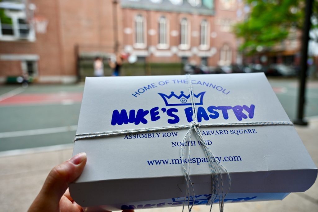
We sat around the corner watching kids playing basketball on a court surrounded by flats which couldn’t have felt more American.
Old North Church (4-minute walk)
The next stop is the Old North Church in North End. It was built in 1723 and is the oldest, still standing, church in Boston (although currently on its third steeple).
Paul Revere’s Midnight Ride
The Old North Church played a key role in the events of the American Revolution when, on the evening of 18 April 1775, two lanterns were shone in the steeple as a sign to the people in Charlestown over the river, that the British Redcoats were coming.
The lanterns were lit by young Robert Newman as part of a warning plan devised by Paul Revere – shine one lantern if they are coming by land, and two if coming by sea. Having completed his task, Robert Newman then escaped through a church window using a third lantern to avoid capture by the Redcoats who had seen the lanterns shining in the steeple.

Meanwhile Paul Revere had rowed across the Charles River and picked up a horse to set off on his Midnight Ride to Lexington, to warn John Hancock and Samuel Adams that the Redcoats were coming. Another rider, William Dawes, travelled on a different route by land to decrease the chances of them being captured together.
Having successfully arrived in Lexington and warned Hancock and Adams of the impending arrival of the Redcoats, Revere and Dawes set off again towards Concord, to warn the colonists there of the Redcoats advance. The Redcoats had heard that there was a stockpile of ammunitions in Concord which they wanted to seize and remove from the colonists.
Along the way, Revere and Dawes met Dr Samuel Prescott (another Son of Liberty) before being stopped by a British patrol. Revere and Dawes were captured (then later released), however, Prescott avoided capture and made it to Concord to raise the alarm there. The colonists were therefore ready for the Redcoats when they arrived.
The events of that night were written into a poem by Henry Wadsworth Longfellow in 1861, many years after the event. Longfellow coined the term Midnight Ride and helped to turn Paul Revere into a folk hero. It also contained the saying:
“One, if by land, and two, if by sea,
and I on the opposite shore shall be”
The poem was responsible for the Midnight Ride becoming a key piece of folklore, and making Paul Revere (rather than the other riders) a Revolution hero.
Inside the Old North Church
The church was very pretty with high sided wooden box pews (and foot warmers) which had to be purchased by wealthy families to help raise funds for the church. It has an impressive gold organ with 4 angels in front of it – the angels are the oldest items in the church having been taken off a ship from France.


Tour of the Bell tower – we took the tour of the bell tower which told the story of how 15-year-old Paul Revere was a bellringer in the church. The church had a set of 8 bells which came from Gloucester, England. Revere was savvy enough to draw up a contract for the bellringers to protect their rights. However, we left slightly disappointed not to have seen any of the 8 bells on the Bell tower tour…

Paul Revere Statue (1-minute walk)
Just behind the Old North Church in a small park stands the bronze Paul Revere Statue, featuring him in a galloping stance on his horse.
Note – the official last stop on the Freedom Trail (Boston) section is the Copp’s Hill Burying Ground in North End, however we decided to walk the other way to the Paul Revere statue and finish our self-guided walk there.

Head to the Waterfront (13-minute walk to Long Wharf)
From the Paul Revere Statue, it’s only a short stroll to Long Wharf where there are plenty of options for a restorative beer on the waterfront.
If you have more time, you can stroll along the waterfront towards the Boston Tea Party Ships and Museum, not an official stop on the Freedom Trail but relevant to this walking tour and period of history.
We saw the Boston Tea Party Ships And Museum from the outside, where visitors were tossing boxes of tea over the sides of a recreated clipper ship moored outside the museum. We would have liked to have visited the Museum but had nothing left in the tank, so it’s on the list for another time.

Dinner – if you’re looking for dinner nearby, there are lots of options. We enjoyed a good meal at The Daily Catch on the Waterfront.
Final thoughts….
The guidebook we used highlighted many more places on the Freedom Trail than described here. It’s actually difficult to focus on so many when you’re walking around – pick some key sights, and leave the rest of your brain and senses free to take in the atmosphere and general feel of the place.
I enjoyed the history that we learnt about, and the beautiful buildings along the way. The city felt very safe and relaxed – very at ease with itself. It made me curious to explore further.
Thank you so much for reading my blog, I hope you found it useful?
For more stories, itineraries, and advice, check out my Related Posts and sign up to receive my blogs by email.
If you have a blog-related question, please do ask in the Comments box and I’ll try to help…
Request please – if you use my photos, then please credit Love Travel Planning on your social media or give me a shout out on Instagram @lovetravelplanning as I am growing my website. Huge thanks.
Enjoy your travels!


Leave a reply
You must be logged in to post a comment.